
Parcel 04-1N-23-0000-0002-0040
Owners
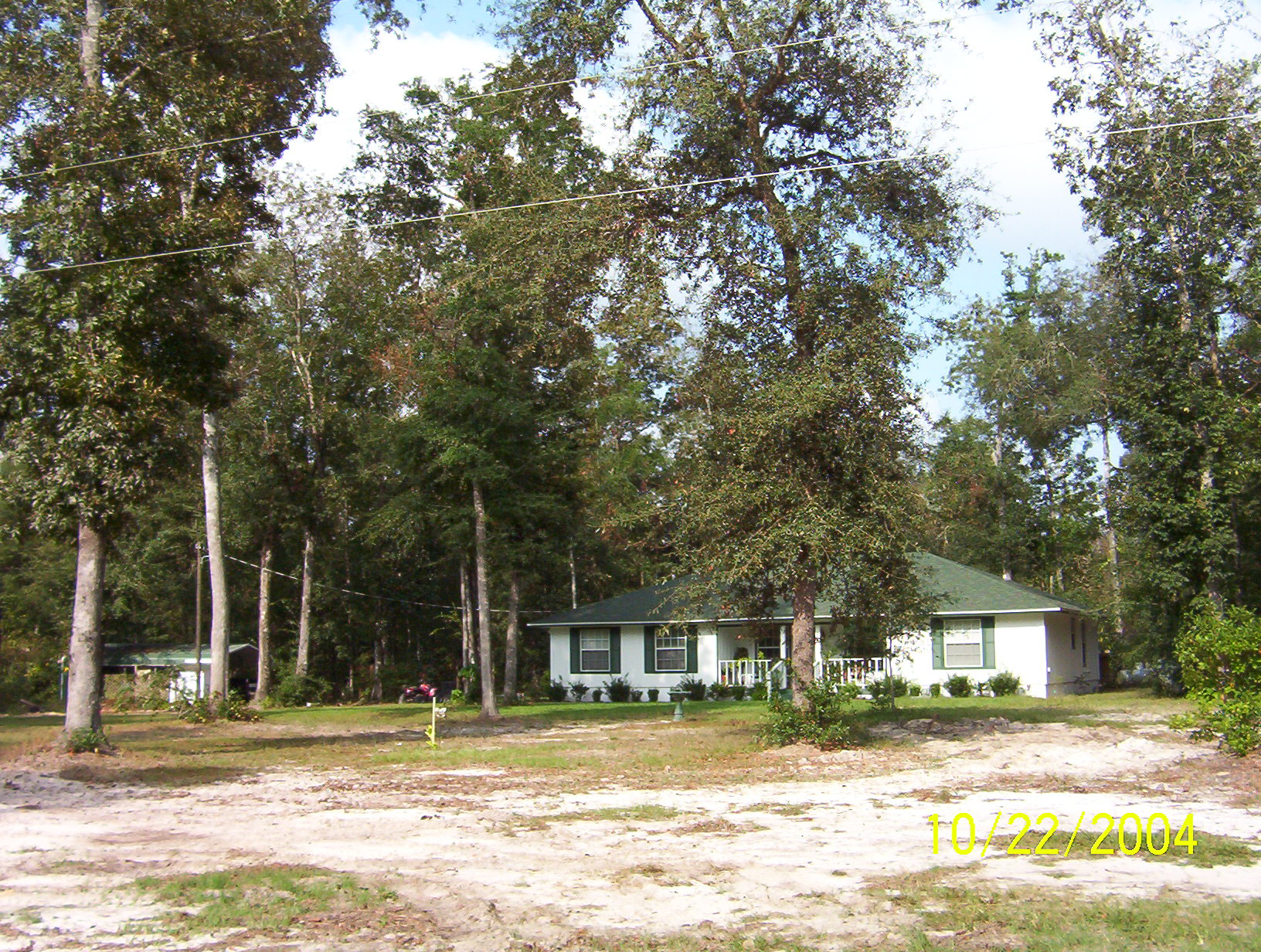
18634 HOOT OWL HOLLOW
HILLIARD, FL 32046
Parcel Summary
| Situs Address | 18634 HOOT OWL HOLW |
|---|---|
| Use Code | 5000: IMPROVED AG |
| Tax District | 6: Drainage Dist |
| Acreage | 25.300 |
| Section | 4 |
| Township | 1N |
| Range | 23 |
| Subdivision | |
| Exemptions | 13: TOT/PERM DV (196.081) (100%) |
Short Legal
PT GOVT LOT 3 OF SEC 4-1N-23EIN OR 2786/40
Values
| 2025 Certified Values | 2026 Preliminary Values | |
|---|---|---|
| Land Value * | $75,427 | $31,086 |
| (+) Improved Value | $210,949 | $216,337 |
| (=) Market Value | $618,799 | $545,237 |
| (-) Agricultural Classification | $5,427 | $5,086 |
| (-) SOH or Non-Hx* Capped Savings ** | $155,294 | $113,289 |
| (=) School Assessed Value | $131,082 | $268,268 |
| County Assessed Value | $131,082 | $134,134 |
| (-) School Exemptions | $131,082 | $268,268 |
| (-) Non-school Exemptions | $131,082 | $134,134 |
| (=) School Taxable Value *** | $0 | $0 |
| (=) County Taxable Value | $0 | $0 |
Document/Transfer/Sales History
| Instrument / Official Record | Date | Q/U | V/I | Sale Price | Grantor | Grantee |
|---|---|---|---|---|---|---|
| LE 2788/1811 | 2025-05-12 | U | Improved | $100 | CONNER BRENDA F | DOVER AUTUM L |
| QC 2786/40 | 2025-05-07 | U | Improved | $100 | CONNER BRENDA | CONNER BRENDA |
| QC 2689/1297 | 2023-12-27 | U | Improved | $100 | DOVER AUTUMN L | EDWARDS ANGELA C |
| QC 2418/1581 | 2020-12-21 | U | Improved | $100 | CONNER BRENDA F | EDWARDS ANGELA C & AUTUMN L |
| QC 2418/1578 | 2020-12-21 | U | Improved | $100 | CONNER BRENDA F & ANGELA C EDWARDS ET AL | CONNER BRENDA F |
| QC 2410/1667 | 2020-11-23 | U | Improved | $100 | CONNER BRENDA F | CONNER BRENDA F & ANGELA C EDWARDS ET AL |
| WD 1029/1163 | 2002-01-02 | Q | Improved | $229,500 | HIGHFILL WALLACE L & JANET E (H&W) | CONNER ALTON L & BRENDA F (H&W) |
Buildings
Building # 1
| Heated Sq Ft | Year Built | Value |
|---|---|---|
| 1506 | 1999 | $187,909 |
Structural Elements
Extra Features
| Code | Description | Length | Width | Units | Unit Price | AYB | % Good Condition | Final Value |
|---|---|---|---|---|---|---|---|---|
| 0510 | GARAGE WD-MTL | 22 | 20 | 440.00 | $26.25 | 2002 | 28% | $3,234 |
| 0937 | WELL | 1.00 | $6,000.00 | 2002 | 100% | $6,000 | ||
| 0936 | SEPTC TANK | 1.00 | $6,000.00 | 2002 | 100% | $6,000 | ||
| 0681 | POLE SHED MTL | 20 | 40 | 800.00 | $11.25 | 2009 | 48% | $4,320 |
| 0681 | POLE SHED MTL | 20 | 16 | 320.00 | $10.65 | 2002 | 28% | $954 |
| 0681 | POLE SHED MTL | 40 | 66 | 2640.00 | $15.00 | 1995 | 20% | $7,920 |
Land Lines
| Code | Description | Zone | Front | Depth | Units | Rate/Unit | Acreage | Total Adj | Value |
|---|---|---|---|---|---|---|---|---|---|
| 005000 | AGRICULTURAL HOMESITE | OR | .00 | .00 | 2.00 | $13,000.00/AC | 2.00 | 1.00 | $26,000 |
| 005600 | TIMBER 3 N SI 70-79 | OR | .00 | .00 | 5.00 | $395.00/AC | 5.00 | 1.00 | $1,975 |
| 005902 | HARDWOOD SI 60-69 | OR | .00 | .00 | 18.30 | $170.00/AC | 18.30 | 1.00 | $3,111 |
| 009910 | MARKET VALUE AGRICULTURAL | OR | .00 | .00 | 23.30 | $13,000.00/AC | 23.30 | 1.00 | $302,900 |
Personal Property
None
TRIM Notices
Property Record Cards
Disclaimer
The Nassau County Property Appraiser's Office makes every effort to produce the most accurate information possible. No warranties, expressed or implied, are provided for the data herein, its use or interpretation. The information contained herein is for ad valorem tax assessment purposes only. The Property Appraiser exercises strict auditing procedures to ensure validity of any transaction received and posted by this office but cannot be responsible for errors or omissions in the information received from external sources. Due to the elapsed time between transactions in the marketplace, and the time that those transactions are received from the public and/or other jurisdictions, some transactions will not be reflected.